Dholera Discovery

Understand Dholera. Plan your next move.

Explore the planning structure, land-use framework and connectivity of Dholera SIR. Whether you are evaluating land or preparing a project, start by understanding the region.

We are a sourcing and coordination business. We do not sell land, we do not publish plot availability, and we do not verify title.

At a glance

What the region actually is

Four numbers that describe the structure of Dholera SIR. Each one comes from a published plan or gazette, and each one means something narrower than it first appears.

  • 920 sq km

    Dholera Special Investment Region

    About 91,970 hectares. The same plan also records an earlier figure of roughly 878 sq km, superseded by the survey-validated figure.

    Source: DSIRDA Development Plan, Table 3-2 and §1.3

  • 22

    Revenue villages in the region

    Of Ahmedabad district. The Development Plan attributes 19 to Dholera taluka and 3 to a second taluka.

    Source: DSIRDA Development Plan §1.3 and DSIRDA Villages Map

  • 6

    Town Planning scheme families

    TP 1 and TP 2 were sanctioned on 3 October 2012; TP 3 to TP 6 on 24 October 2013.

    Source: Gujarat Government Gazette, Part IV-C

  • 27

    Sub-schemes within those families

    The split was made by the Town Planning Officer under section 63 of the 1976 Act. The gazette notifications recite the split list themselves.

    Source: DSIRDA Split TP Boundary sheet and the gazette notifications

421.47 sq km

Area under the Town Planning schemes

The sum of the six scheme areas published on the DSIRDA split-boundary sheet. It is not the area of the region, and it says nothing about what is developed or available.

Source: DSIRDA Split TP Boundary sheet (sum of the 27 printed sub-scheme areas)

22.54 sq km

Activation Area

Formed under Town Planning Schemes 2A and 4A. It is a designation of where development is concentrated, not a statement that the land is built on.

Source: DICDL published pages (About Us, FAQs)

Town Planning schemes

The six scheme families

Dholera SIR is divided into six Town Planning scheme families, and each family is divided into sub-schemes. The areas below are the sum of the sub-scheme areas published on the DSIRDA split-boundary sheet.

TP 1

5,109.1 ha 51.09 km²

Sub-schemes
6
Notifications read
2 of 6
Sanctioned
3 October 2012
Notification
SIRAA/03/2012/566-A

Sanctioned without modifications. 2 of 6 sub-schemes in this family have a gazette notification that was located and read in full.

Explore TP 1 — sub-schemes, areas and notification status

TP 2

10,232.48 ha 102.32 km²

Sub-schemes
8
Notifications read
3 of 8
Sanctioned
3 October 2012
Notification
SIRAA/04/2012/566-B

Sanctioned without modifications. 3 of 8 sub-schemes in this family have a gazette notification that was located and read in full.

Explore TP 2 — sub-schemes, areas and notification status
TP 3

6,631.9 ha 66.32 km²

Sub-schemes
4
Notifications read
2 of 4
Sanctioned
24 October 2013
Notification
SIRAA/06/2013/439

Sanctioned subject to a Schedule of modifications. 2 of 4 sub-schemes in this family have a gazette notification that was located and read in full.

Explore TP 3 — sub-schemes, areas and notification status

TP 4

6,021.95 ha 60.22 km²

Sub-schemes
3
Notifications read
1 of 3
Sanctioned
24 October 2013
Notification
SIRAA/07/2013/440

Sanctioned subject to a Schedule of modifications. 1 of 3 sub-schemes in this family have a gazette notification that was located and read in full.

Explore TP 4 — sub-schemes, areas and notification status

TP 5

7,425.25 ha 74.25 km²

Sub-schemes
4
Notifications read
2 of 4
Sanctioned
24 October 2013
Notification
SIRAA/08/2013/441

Sanctioned subject to a Schedule of modifications. 2 of 4 sub-schemes in this family have a gazette notification that was located and read in full.

Explore TP 5 — sub-schemes, areas and notification status

TP 6

6,725.88 ha 67.26 km²

Sub-schemes
2
Notifications read
1 of 2
Sanctioned
24 October 2013
Notification
SIRAA/09/2013/442

Sanctioned subject to a Schedule of modifications. 1 of 2 sub-schemes in this family have a gazette notification that was located and read in full.

Explore TP 6 — sub-schemes, areas and notification status
  • The sheet prints an area for each of the 27 sub-schemes. The per-scheme areas and the total are the sum of those printed areas; the sheet prints neither.
  • A notification reference means a notification was located and read in full in the reviewed source set. It is not a statement that no other notification exists.
  • Every notification read sanctions a PRELIMINARY scheme. No final-scheme sanction notification was located for any scheme.
  • TP 2/A's sanction is expressly conditioned on the outcome of PIL No. 227/2014 in the Gujarat High Court.
  • The relative position of the schemes is published only on DSIRDA plan sheets that may not be reproduced, so no arrangement is shown anywhere on this site.
Explore every scheme and sub-scheme

Connectivity

What is connected, and what is still being built

The region has a 109 km access-controlled expressway under implementation, a 24.4 km freight rail alignment under implementation, an airport site under construction, and a completed internal network of 72 km. A planned facility is never the same as an open one.

Connectivity and infrastructure
Under construction

Ahmedabad–Dholera expressway, 109 km, four-lane, access controlled, implemented by NHAI.

Under construction

Freight rail, 24.4 km broad gauge, Bhimnath to Dholera, under implementation by Western Railway.

Under construction

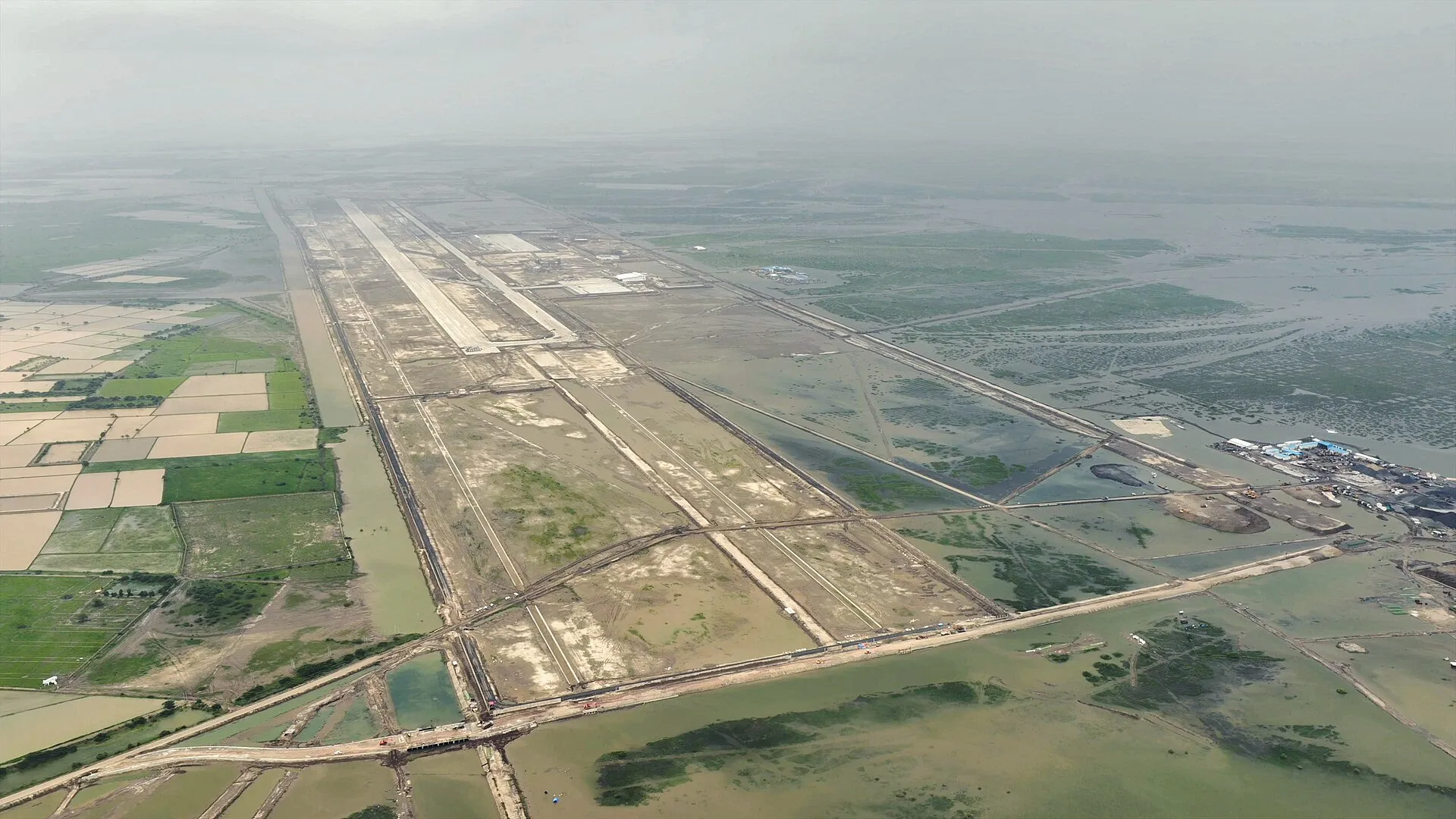
Dholera International Airport site at Navagam, about 20 km from Dholera. Not operational, and not on the Airports Authority of India’s airport list.

In service

Internal road network of 72 km, a 50 MLD water treatment plant, a 10 MLD sewage treatment plant and a 20 MLD common effluent treatment plant.

Dholera — a national development vision

The wider context

Dholera sits inside a national programme of planned industrial cities. This video is third-party coverage of that programme and of the Dholera SIR — it is published here as context, and the business behind it is a property media channel, not a government body.

PM Modi on Dholera SIR | India's Biggest Smart City Investment Explained

Published by Highlands Property Pulse. This video is hosted on YouTube. Nothing is requested from YouTube until you press play — pressing play makes a request to YouTube, and YouTube may set its own cookies under its own policy.

Watch on YouTube (opens in a new tab)

The video is hosted on YouTube and is not an official government recording. Playing it makes a request to YouTube, which happens only when you choose to play it. It is included for context and carries no implication of endorsement, government affiliation or any guaranteed infrastructure outcome.

Illustrative photograph. An aerial view of the Dholera airport site, the cleared runway area cut through the green surrounding land

Who you are talking to

Pehle Desh Seva. Ab Janta Seva.

Top Dholera is built around Subedar Major Dr. Bharat Kumar Pandey. After serving the nation in the Indian Army, he brought that discipline, responsibility and public service into his next chapter: a resource sourcing and coordination business for Dholera.

The philosophy has not changed. It is the reason the site tells you plainly what is confirmed and what is not.

Read the founder’s story

Illustrative photograph. Two site staff in high-visibility vests and hard hats inspecting a concrete structure

One conversation

Your requirement. The right resource. One conversation.

Send us what you need and where. We will tell you what can be supplied, what has to be sourced, and what would need to be confirmed first.

TOP DHOLERA — FROM LAND TO EXECUTION. YOU REQUIRE IT. WE SOURCE IT.

WhatsApp us